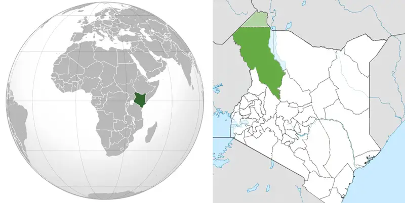
14th September 2013 Giant aquifers discovered in drought-prone Kenya Massive new reserves of groundwater have been found in Turkana County, northern Kenya – enough to supply the entire country for 70 years.
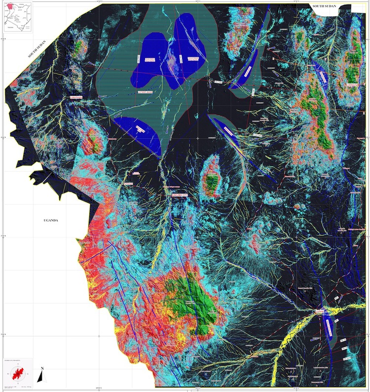
Huge underground water reserves have been found in Turkana, one of Kenya’s driest and poorest regions. The discoveries were made by Radar Technologies International (RTI), a natural resources exploration firm, during a survey conducted for the Kenyan Government on behalf of the UN. The aquifers were detected using the WATEX System – a state-of-the-art, space-based exploration technology. Both shallow and deep aquifers were surveyed across northern and central Turkana County in an effort to identify supplies to combat drought and water scarcity for the 2 million people living in the region. It was found that Turkana hosts a minimum reserve of 250 billion cubic metres of water, replenished mainly by rainfall in the Kenyan and Ugandan highlands at a rate of 3.4 billion cubic metres per year. This new wealth of water represents nearly double the amount that Kenyans consume today. It could dramatically improve the livelihoods of Turkana's people, most of whom live in poverty and have limited access to basic services and clean water.
Two major aquifers were recorded and proven by drilling. The Lotikipi Basin Aquifer is estimated to store 207 billion cubic metres of water, the same volume of nearby Lake Turkana. About the size of the US state of Rhode Island, this aquifer replenishes at a rate of 1.2 billion cubic metres a year. This paleo lake could be part of the “Land of Marvels”, the ancient sources of the Nile that were explored by Egyptian Pharaoh Queen Hatshepsut some 3,500 years ago. The Lodwar Basin Aquifer is situated within a short distance of Lodwar town and Turkana’s oil reserves. It is fed by the perennial Turkwel River and has an estimated reserve of 10 billion cubic metres. RTI recorded three other large structures – Gatome, Kachoda and Nakalale – which may prove to store a combined 30 billion cubic metres if confirmed by drilling. In addition to deep reserves, RTI also mapped 2 billion cubic meters of water passing only a few metres under the ground and easy to reach, significantly raising the prospect for local agriculture activities.
Looking ahead, RTI has recommended that all measures be taken to ensure the sustainability and viability of these newly discovered resources. Their work also establishes a new basis upon which future investigations and mapping in Kenya can be based. The WATEX System detects water with its unique method of processing and interpreting remote sensing, oil industry and conventional data. The WATEX maps have a 6.25-metre surface accuracy and have been proven to locate underground water with over 94% certainty in most areas. Known for its rapid and large-scale mapping capabilities, WATEX has been utilised in a number of countries to find water for international aid agencies and foreign governments – most recently in Ethiopia, Angola, Chad, Darfur and Afghanistan. During the Darfur Crisis, RTI used the WATEX to find water for thousands of Sudanese refugees. Its partners have used WATEX groundwater maps to drill over 1,500 wells to help alleviate the crisis in Darfur. Announcing these latest findings at the opening session of UNESCO's Strategic and High-Level Meeting on Water Security and Cooperation, Judi Wakhungu, Cabinet Secretary, said the results were a critical scientific breakthrough for Kenya: “The news about these water reserves comes at a time when reliable water supplies are highly needed. This newly found wealth of water opens a door to a more prosperous future for the people of Turkana and the nation as a whole. We must now work to further explore these resources responsibly and safeguard them for future generations.” Stressing Kenya’s vulnerability and water insecurity caused by erratic rainfall patterns and the influence of climate change, Judi Wakhungu said more research and investment were now needed to identify and understand groundwater aquifers and improve capacity for monitoring and assessment of these resources. “UNESCO is proud to be a part of this important finding, which clearly demonstrates how science and technology can contribute to industrialisation and economic growth, and to resolving real societal issues like access to water,” said the Assistant Director-General for Natural Sciences, Gretchen Kalonji. “It is indeed in line with UNESCO’s vision for science for sustainable development and we will continue to support Africa, to unlock the full potential of its invisible water wealth.” Gallery: http://www.unesco.org/new/en/media-services/multimedia/photos/kenya-groundwater-survey/
Comments »
|