14th February 2014 Satellite technology can be used to count whales With new satellite technology, it is becoming possible to count individual whales and to automatically estimate their population size. Using Very High Resolution (VHR) satellite imagery, alongside image processing software, researchers were able to detect and count the number of whales breeding off the coast of Argentina.
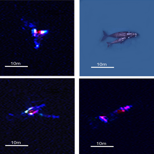
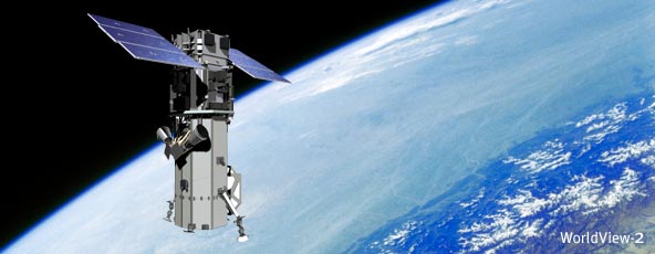
The new method, published this week in the journal PLoS ONE, could revolutionise how whale populations are estimated. Marine mammals are extremely difficult to count on a large scale and traditional methods – such as counting from platforms or land – can be costly and inefficient. Lead author Peter Fretwell from the British Antarctic Survey (BAS): “This is a proof of concept study that proves whales can be identified and counted by satellite. Whale populations have always been difficult to assess; traditional means of counting them are localized, expensive and lack accuracy. The ability to count whales automatically, over large areas in a cost effective way will be of great benefit to conservation efforts for this and potentially other whale species.” Previously, satellites have provided limited success in counting whales – but their accuracy has improved in recent years. The BAS team began by taking a single WorldView2 satellite image of a bay where southern right whales gather to calve and mate. Driven to near extinction, these whales have made a limited recovery following a whaling ban. In recent years, however, many deaths have been seen on their nursery grounds at Peninsula Valdes. Their population size is now unknown but with this sharp increase in calf mortality, estimates are needed.
The enclosed bays in this region contain shallow, calm waters – increasing the chance of spotting the whales from space. Three main criteria were used to identify whales: objects visible in the image should be the right size and shape; they should be in the right place (where whales would be expected to be) and there should be no (or few) other types of objects that could be mistaken as whales. Whales in the image were manually counted, finding 55 probable whales, 23 possible whales and 13 sub-surface features. Several automated methods where then tested against these numbers. A ‘thresholding’ of the Coastal Band of the WorldView2 image gave the greatest accuracy. This part of the image uses light from the far blue end of the spectrum, which penetrates the water column deeper and reveals more whales. This technique found 89% of probable whales identified in the manual count. This semi-automated technique needs some user input to identify the best threshold. Future satellite platforms, however, will provide much higher quality imagery and Worldview3 is planned to be launched later this year. This will allow for greater confidence in identifying whales and differentiating mother and calf pairs. Such technological advancements may also allow scientists to apply this method to other species.
Comments »
|